Newsletter April 2011
Summertime is traveltime and hopefully you have your carNAVi ready to guide you on your trip to the most famous vacation spots.
Last month we started the release of the first maps for Europe. Recently we have added the Netherlands to our repertoire of free maps in the carNAVi Store and more have to come later this year.
And the carNAVi Store has some new items like travel charger and other specials.
Enjoy reading,
Your carNAVi Team
Summertime is traveltime
 This year, don’t waste any time being lost (or disagreeing on directions) while you’re on vacation. Speaking of things not to do on vacation; remember that time you forgot where you left your car in a giant amusement parking lot? carNAVi GPS will help you make sure that doesn’t happen again. While you’re at it, use your carNAVi to find a gas station or look for restaurants nearby.
GPS, or Global Positioning System, allows you to see a real-time projection of your present coordinates onto an accurate map of your surrounding area. Taking a GPS unit on vacation can save you lots of time and hassle. Follow these steps to use carNAVi on your vacation.
2. Do some itinerary planning and preparing. Locate the names and addresses of important places on your vacation, such as your hotel, a bank and airport. Add these locations to your GPS as waypoints so that you can easily refer to them or get directions on the fly. Also, use the GPS to plan days of sightseeing by plugging in one stop after another so you can seamlessly make your way through the day with the help of GPS. If some places are still not listed in your carNAVi, use an online services like WikiMapia (http://wikimapia.org/) to find places and get the coordinates, which you may enter into your carNAVi as waypoints.
Destination EUROPE

To make travelling abroad easier, carNAVi users may download separate maps for each country or region. carNAVi is the only navigation provider that offers additional maps for other countries – free of charge.
This month the new addition to the store is a map of the Netherlands.
The detailed road network of the map includes major highways, secondary highways and residential streets. Thousands of POI, like Restaurants, Hotels, Shopping Centers and Tourist Spots for most cities are also included. Other maps including France, Germany, Italy and other countries are coming soon.
How to download:
To get the additional mapsets, please visit the “GPS Maps‘ category in the online store.
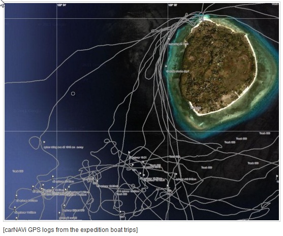
carNAVi supports ‘The Born Expeditions’
“They are easily the largest living creatures on the planet. Measuring up to thirty meters or about 100 feet in length, they are no doubt rulers of the ocean. Yet they can also be the gentlest and most charismatic beings.” Whales. Doc Ferds Recio and Kiko Rustia go on separate voyages to meet these giants face to face.
carNAVi supports this fantastic wildlife show and documentaion with navigation equipment and know how.


